
Bathymetric LiDAR Mapping Services
We specialize in high-resolution bathymetric LiDAR, utilizing a 2-in-1 sensor to map underwater environments and dry land simultaneously. At a fraction of the cost of older SHOALS technology, our system provides centimeter-accurate depth resolution. This is the premier choice for Texas developers and agencies tasked with mapping riverbeds, managing water utility assets, or protecting the Texas coastline from storm-driven erosion.
SERVICE
Bathymetric LiDAR Mapping Services
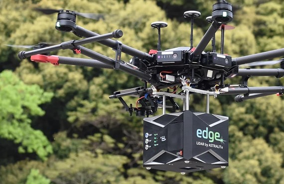
Lonestar Lidar is pushing the boundaries of spatial data with our latest capability: Integrated Bathymetric LiDAR. By pairing a high-endurance, gas-powered UAV with our advanced 2-in-1 sensor, we simultaneously capture sub-surface and terrestrial terrain. This specialized configuration allows us to deliver high-fidelity underwater mapping with centimeter-level precision, a level of detail previously unavailable in the regional market.
AIRBORNE LIDAR BATHYMETRY
Bathymetric LiDAR Drone Mapping Services
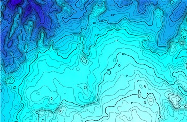
digital BATHYMETRIC LIDAR maps
Bathymetric LiDAR Topographic Mapping
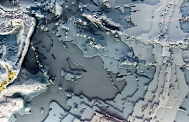
digital elevation models dems
Bathymetric LiDAR 3D Digital Elevation Models (DEMs)
Bathymetric LiDAR Mapping Services
Bathymetric LiDAR mapping services are based on the technology and application of airborne laser altimetry or Light Detection And Ranging aka LiDAR.
For decades, the private sector has relied on aerial LiDAR for land-based topography, but mapping “below the waterline” remained a specialized and expensive challenge. Legacy bathymetric systems were bulky, requiring large planes and significant capital, often making them impractical for local infrastructure or environmental projects.
LoneStar Lidar introduces a new generation of data collection. Our advanced 2-in-1 LiDAR platform uses a specialized blue-green wavelength to penetrate water surfaces with centimeter-level precision. Because our system is light enough to be deployed via gas-powered UAV, we eliminate the overhead of traditional aviation. Whether you are mapping the shallow Gulf Coast, clear Texas rivers, or municipal reservoirs, we provide the underwater intelligence you need without the “SHOALS” price tag.
Advantages of our new 2-in-1 LiDAR System:
-
Measuring and mapping of underwater features and seafloors, clear lake bottoms and riverbeds at a centimeter-level depth resolution.
-
Cost-effective gas-powered LiDAR drone mapping for any size project verses the full-size aircraft required for SHOALS.
-
Our dual system does both airborne LiDAR bathymetry and aerial terrestrial LiDAR for bathymetric LiDAR projects with adjoining shorelines or coastline.
-
Our in-house licensed land surveyor guarantees highly accurate 3D digital modeling and high-resolution digital mapping.
About Bathymetric LiDAR Mapping
Precision mapping of submerged environments is more accessible than ever with Lonestar Lidar’s advanced bathymetric solutions. By utilizing state-of-the-art Light Detection and Ranging (LiDAR) technology, we capture high-resolution data of underwater terrain without the need for traditional sonar vessels. Whether your project requires detailed modeling of a Texas riverbed, a municipal reservoir, or the Gulf seafloor, our airborne systems deliver centimeter-level accuracy. From civil engineering to environmental monitoring, our dual-purpose LiDAR provides the versatile data needed for the state’s most complex infrastructure challenges.
What is Bathymetric LiDAR Mapping used for?
-
Supporting large-scale civil engineering and infrastructure projects across the Texas Gulf Coast. By integrating bathymetric data with aerial terrestrial LiDAR, we provide comprehensive topographic surveys for bridge construction, port expansions, and coastal highway reinforcements.
-
Advanced environmental and habitat assessments, including the mapping of sensitive oyster beds, seagrass meadows, and inland wetland ecosystems. Our high-resolution sensors allow for the precise tracking of vegetation health and submerged habitats in Texas's diverse bay systems and wildlife preserves.
-
Rapid-response disaster impact mapping following hurricanes, tropical storms, or flash flooding events. We specialize in quantifying coastal erosion and shoreline recession, providing the dual-surface data required for state-funded beach nourishment and flood mitigation strategies
-
High-fidelity bathymetric modeling of Texas reservoirs, riverbeds, and seafloors. We generate precise 3D digital terrain models (DTMs) of submerged features, offering critical data for dredging operations, dam inspections, and utility crossings in inland waterways and shipping channels.
-
Empowering specialized scientific research, from geological surveys of sedimentary shifts to aquatic biology studies. Our data supports academic and private-sector initiatives focused on hydrologic modeling and the sustainable management of Texas’s natural water resources.
What is Airborne LiDAR Bathymetry?
Bathymetry is the study of the physical features of the sea floor. This is often done with bathymetric LiDAR mapping services. Bathymetric LiDAR is the technology and application of airborne laser altimetry or Light Detection And Ranging, LiDAR, for mapping underwater features and seafloor topography. Lonestar Lidar specializes in the high-precision analysis of submerged topography through advanced Airborne Bathymetric LiDAR. By utilizing dual-frequency laser altimetry, we capture seamless datasets that bridge the gap between dry land and underwater features. This technology generates centimeter-accurate Digital Elevation Models (DEMs) and 3D terrain maps of riverbeds, lakes, and coastal basins. By deploying these sensors via high-endurance, gas-powered drones, we have rendered the bulky, expensive “SHOALS” systems of the past obsolete. Our integrated 2-in-1 platform offers a cost-effective, mission-ready solution for Texas civil engineering, land surveying, and infrastructure monitoring.
SHOALS Bathymetric LiDAR
Historically, high-resolution underwater mapping was restricted to SHOALS (Scanning Hydrographic Operational Airborne Lidar Survey). Developed by the U.S. Army Corps of Engineers for monitoring tidal inlets and sand movement, these systems were groundbreaking but burdened by extreme costs. Because SHOALS hardware is massive and requires a manned, full-sized aircraft, it remains financially out of reach for most private-sector projects. Lonestar Lidar provides the modern alternative. Our compact, drone-integrated systems deliver the same navigational and charting capabilities without the prohibitive overhead of aviation fuel and pilot crews, making professional bathymetry accessible for local Texas developments.
Bathymetric LiDAR Mapping Services
Environmental Conservation: Coral Reef Mapping
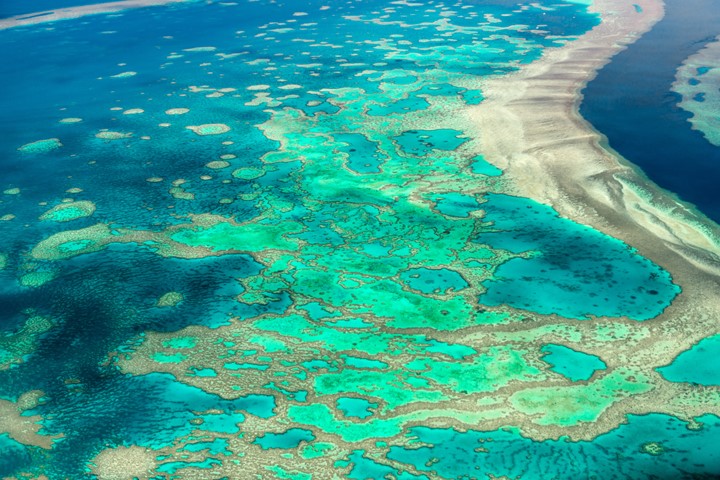
Coral reefs are one of the most diverse and beautiful ecosystems on our planet. They are also one of the most important ecosystems on Earth. Coral reefs make up less than 1% of the ocean floor but are home to more than 25% of all marine species. They provide a habitat for thousands of species of fish, coral, and other marine life. This has earned coral reefs the nickname, “rain forests of the sea.” Coral reefs also protect coastlines from erosion and storms.
Coral reefs are also one of the most endangered ecosystems on the planet. Unfortunately, climate change, pollution, and other human activities like the use of sunscreen all put the worlds coral reefs in danger. Coral reef mapping and the study of coral reefs is essential for their conservation. Scientists use cutting-edge technologies like bathymetric LiDAR to map and study these delicate ecosystems. Bathymetric LiDAR mapping allows scientists to create detailed maps of the reef structure helping them track coral reef changes over time. This makes bathymetric LiDAR technology one of the most important tools for conservation efforts.
Bathymetric LiDAR is a laser scanning or remote sensing technology which uses light to measure the depth of water. It maps coral reefs and other underwater features with great accuracy. Bathymetric LiDAR mapping helps scientists understand the ecology of coral reefs. LiDAR data also helps scientists learn more about the three-dimensional structure of coral reefs and how they change over time. It provides information about the size, shape, and health of coral reefs. This information gives scientists a better understanding of how coral reefs respond to environmental changes to develop strategies to protect them.
Scientists like Dr. Asner, PhD, Director of Asner Labs hire Aerial Surveying, Inc. to perform airborne LiDAR bathymetry mapping for research grants for studying and preserving coral reefs. LoneStar offers a cost-effective solution to airborne LiDAR bathymetry mapping compared to traditional SHOALS systems. This helps scientists like Dr. Asner use bathymetric LiDAR mapping to better understand coral reefs and their ecology to help preserve them for future generations.